
Garmin GPSMAP 79s
4.2Editor score
Floating rugged design
Built-in compass
Long battery life
Navigating the open waters requires precision and reliability. A quality marine GPS unit ensures you stay on course and avoid hazards while enjoying your time on the water with confidence and peace of mind.
We evaluated ten leading models based on display clarity, mapping accuracy, sonar integration, and connectivity options. Our comparison focuses on real-world performance for sportboats, cruisers, and handheld needs.
Each pick showcases specific strengths tailored to different boating styles. While prices fluctuate based on retailers and bundles, this list highlights the most capable units available for your specific vessel requirements.
4.2Editor score

4.7Editor score

5.0Editor score
As an Amazon Associate we earn from qualifying purchases.
The following table provides a side-by-side look at the key specifications and capabilities of each unit to help you quickly identify the best fit for your boating needs.



The Simrad GO Chartplotter stands out as a versatile multifunction display that combines GPS navigation with robust sonar and radar capabilities. It earns our top choice for value due to its comprehensive feature set at a competitive price point for sportboats and smaller cruisers.
We may earn a commission when you buy through this link, at no additional cost to you.
It features a preloaded C-MAP Discover card that offers high-resolution bathymetric contours and detailed vector charts. The included HDI transducer supports CHIRP sonar and DownScan Imaging, helping you identify fish targets and bottom structure with remarkable clarity.
While the unit offers excellent integration through NMEA 2000 and Wi-Fi, users should note that some advanced radar features require additional hardware purchases. However, the built-in connectivity for mirroring to smartphones ensures you stay connected to your marine data on the fly.
This unit is ideal for boaters who want a complete navigation system without overspending. If you prioritize detailed mapping and the option to expand with radar, the Simrad GO provides a reliable foundation for your marine electronics suite.
The C-MAP Discover card provides custom depth shading and tide data, giving you critical information for safe navigation in changing water conditions.
Seamless NMEA 2000 support allows this unit to communicate with other onboard devices like VHF radios and engines for a unified cockpit experience.
We may earn a commission when you buy through this link, at no additional cost to you.
The Garmin ECHOMAP UHD2 94sv is a powerhouse for anglers and captains who demand high fidelity sonar and intuitive controls. Its sunlight-readable touchscreen and included transducer make it a ready-to-go solution for modern marine navigation and fishing.
We may earn a commission when you buy through this link, at no additional cost to you.
This unit excels with its GT56 transducer which delivers traditional, ClearV, and SideV scanning sonars. These features allow you to see detailed images of fish and structure beneath and beside the boat, significantly improving your chances of a successful catch.
The ability to wirelessly connect to compatible Force trolling motors adds a layer of automation that simplifies maneuvering and station keeping. While the price is higher than basic units, the integration of Navionics+ charts and advanced sonar justifies the investment for serious users.
Choose this model if you want a premium experience that combines fishing and navigation seamlessly. It is perfect for those who value ease of use and are willing to invest in top-tier display technology for their vessel.
SideV and ClearV scanning technologies provide distinct views of the underwater environment, helping you locate structure and fish with precision.
Wireless integration with trolling motors lets you control speed and follow routes directly from the chartplotter screen without extra remotes.
We may earn a commission when you buy through this link, at no additional cost to you.
The Garmin GPSMAP 79s is an essential tool for safety and backup navigation. Its rugged design and ability to float make it ideal for kayaks, small boats, or as a secondary device when out on the open ocean.
We may earn a commission when you buy through this link, at no additional cost to you.
This handheld supports multiple satellite constellations to ensure reliable tracking even in challenging environments. The worldwide basemap gives you coverage for coastal areas and inland waters without needing additional map purchases or subscriptions.
While it lacks the advanced sonar of larger chartplotters, its primary role is tracking position and heading efficiently. The battery life of up to 20 hours ensures it lasts through long trips without needing frequent recharges or replacements.
For boaters on a budget or those seeking a reliable backup, this unit is unbeatable. It provides peace of mind by ensuring you always have a way to mark waypoints and navigate home safely.
The fogproof glass and IPX6 water resistance rating protect the device from splashes, rain, and accidental drops in the water.
Memory allows saving thousands of waypoints and routes so you can retrace your path or find popular fishing spots easily later.
We may earn a commission when you buy through this link, at no additional cost to you.
The Garmin GPSMAP 943xsv delivers exceptional underwater imaging capabilities for anglers who demand the highest quality sonar data. Its ultra high-definition scanning sonar provides incredibly detailed views of the seabed and fish targets.
We may earn a commission when you buy through this link, at no additional cost to you.
This model supports Panoptix sonar which offers real-time imaging in all directions. The improved display optics ensure that even in bright sunlight, the details remain sharp and easy to interpret for accurate navigation decisions.
While it comes with pre-loaded mapping, users should verify their specific region coverage before heading out. The system requires additional sensors for full Panoptix functionality which can increase the total cost of the setup significantly.
Choose this unit if you are an avid angler focused on precision fish finding. The clarity of the sonar images makes it worth the investment for those who want to see every detail beneath the boat.
Ultra high-definition scanning ensures that even small fish or subtle structure changes are visible on the screen without blur.
Support for Panoptix means you can add live view transducers for real-time scanning ahead of or behind the boat.
We may earn a commission when you buy through this link, at no additional cost to you.
The Garmin GPSMAP 1243xsv is a large format chartplotter designed for serious boaters who need extensive navigation and engine control capabilities. It supports third-party devices through OneHelm digital switching and connects to various marine engines for data monitoring.
We may earn a commission when you buy through this link, at no additional cost to you.
With preloaded Navionics charts, you get detailed coastal coverage right out of the box. The ability to control your marine experience remotely adds convenience for captains managing multiple systems from different points on the boat.
This unit is quite expensive and requires professional installation to fully utilize its network connectivity and radar features. It is best suited for larger vessels where a comprehensive electronics suite is necessary for safe operation.
If you need a top-tier system with large screen visibility and engine integration, this is a strong candidate. It offers the scalability needed for expanding your marine electronics over time.
OneHelm digital switching allows you to manage engine and system controls through the chartplotter interface for a cleaner dashboard.
Superior network connectivity ensures that sensors and other devices communicate effectively for a reliable and integrated marine system.
We may earn a commission when you buy through this link, at no additional cost to you.
The Garmin GPSMAP 79sc stands out among handheld units because it comes preloaded with BlueChart g3 coastal charts. This feature provides detailed navigation data right out of the box without needing extra map purchases or setup steps.
We may earn a commission when you buy through this link, at no additional cost to you.
Like other rugged handhelds, it floats and is water resistant with an IPX6 rating. The built-in tilt-compensated electronic compass and barometric altimeter add significant utility for hikers or kayakers who need altitude and heading data.
While it is more expensive than the base handheld model, the inclusion of detailed coastal charts makes it a better value for those planning extensive trips. However, the screen size is still limited compared to fixed units.
This device is perfect for adventurers who want reliable navigation and detailed charts in a portable package. It is especially useful for kayakers and sailors who need a backup navigation tool that includes chart data.
BlueChart g3 charts offer high-resolution depth contours and points of interest to help you navigate coastal waters safely.
The tilt-compensated compass ensures accurate heading information even if the device is not held perfectly flat in your hand.
We may earn a commission when you buy through this link, at no additional cost to you.
The Garmin GPSMAP 1022xsv is a ten inch combo unit that provides a large viewing area for navigation and entertainment. It is designed to be integrated into a larger system with external sensors like transducers and radar.
We may earn a commission when you buy through this link, at no additional cost to you.
It comes with a basic basemap and is ready to connect to Garmin sonars for enhanced fish finding. This makes it an excellent choice for boaters who already have or plan to buy separate sonar components.
Without a transducer included in the package, you must budget for additional hardware to unlock its full potential. However, the display quality and connectivity options make it a reliable platform for marine navigation tasks.
Select this unit if you want a large screen at a reasonable price and do not need an all-in-one transducer setup. It serves well as a central display for boats that require expandable electronics.
The ten inch screen offers plenty of real estate to view charts and sonar data simultaneously for better situational awareness.
You can add compatible sonars and radar later to build a custom marine system that meets your specific requirements and budget.
We may earn a commission when you buy through this link, at no additional cost to you.
The Garmin GPS 76 is a classic handheld navigator that focuses on core GPS functionality without unnecessary complications. It provides WAAS enabled tracking for improved accuracy and reliability in coastal and open water environments.
We may earn a commission when you buy through this link, at no additional cost to you.
Its simple interface includes a trip computer that tracks current speed, average speed, and distance. This is useful for boaters who want to monitor their travel metrics without needing advanced mapping features or large screens.
The device runs on two AA alkaline batteries and offers up to 16 hours of use which is sufficient for day trips. While it lacks modern color displays it remains a dependable tool for basic navigation needs.
This unit is ideal for casual boaters who need a straightforward way to find their way back. It is a great backup option for those who prefer simplicity and long battery life over advanced graphics.
WAAS enabled GPS provides enhanced accuracy and stability for your position tracking even in areas with signal obstructions.
The built-in trip computer helps you monitor your journey metrics like distance traveled and speed averages efficiently.
We may earn a commission when you buy through this link, at no additional cost to you.
The Garmin GPSMAP 1223xsv is a top-tier chartplotter and fishfinder combo designed for serious boaters. Its 12-inch IPS display ensures clear viewing in all lighting conditions including direct sunlight which is crucial for long days on the water.
We may earn a commission when you buy through this link, at no additional cost to you.
It features a powerful 5,000-watt traditional CHIRP sonar that offers excellent target separation and clarity in deep water. This capability allows you to distinguish between closely spaced fish and structure with high precision.
Connectivity is a strong point with J1939 networking for engines and NMEA 2000 for other electronics. The inclusion of Wi-Fi and Bluetooth allows you to share data and access charts via your smartphone easily.
This unit is the best choice for those who want a comprehensive system with no compromises. Whether you are navigating complex coastlines or hunting fish, this unit provides the performance and features you need.
The high wattage sonar penetrates deep water effectively to provide clear images of fish and bottom structure even in challenging conditions.
J1939 and NMEA 2000 networking let you integrate the chartplotter with engines and autopilots for a fully connected marine system.
We may earn a commission when you buy through this link, at no additional cost to you.
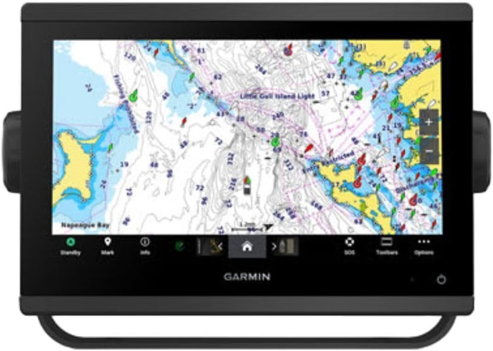
The Garmin GPSMAP 743 is a compact chartplotter focused purely on navigation without integrated sonar capabilities. It comes with preloaded Navionics+ mapping which is a great starting point for coastal boaters looking to stay on course.
We may earn a commission when you buy through this link, at no additional cost to you.
Its 7-inch display is bright and easy to read making it suitable for smaller consoles or dashboards. The unit is designed to be simple and intuitive so you can quickly input waypoints and view your route.
While it lacks sonar support it can still be expanded with external devices if needed. The high rating from users suggests that it performs its core navigation tasks reliably and efficiently without unnecessary complexity.
This unit is perfect for boaters who primarily need a chartplotter and plan to use a separate fish finder. It delivers accurate navigation data and essential mapping features in a user-friendly package.
This device is optimized for chart viewing and route planning ensuring you have accurate maps for safe passage without sonar distractions.
The inclusion of Navionics+ means you get detailed coastal charts right out of the box to help you plan your trips effectively.
We may earn a commission when you buy through this link, at no additional cost to you.
Selecting the right marine GPS unit involves balancing display quality, mapping data, sonar integration, and connectivity features to suit your specific vessel and activities.
Larger displays provide better visibility and more screen real estate for detailed charts and sonar data. Look for units with high brightness and sunlight readability so you can read the screen clearly even on bright days.
Prioritize a display size that fits your console without cluttering the cockpit. A high-quality IPS panel ensures viewing angles remain consistent as you move around the boat.
Detailed mapping is crucial for safe navigation especially in coastal waters or unfamiliar inland areas. Check whether the unit comes preloaded with charts for your region or if you need to buy them separately.
Consider chart providers like Navionics or C-MAP based on their depth contours and update frequency. Reliable mapping ensures you avoid shallow spots and find points of interest easily.
If fishing is a primary activity, the type of sonar supported is vital. Look for CHIRP sonar and scanning technologies like SideV or DownV for clear images of fish and structure.
Ensure the unit is compatible with the transducer you plan to use. Some systems include transducers while others require separate purchases so factor this into your total budget.
Modern boats often have multiple electronics that need to communicate. Look for NMEA 2000 support which allows the GPS to connect with engines, sensors, and autopilots seamlessly.
Wi-Fi and Bluetooth connectivity enable you to share data with smartphones or tablets for convenient updates and remote access. This feature enhances the usability of your navigation system.
Marine electronics face harsh conditions including salt spray, vibration, and intense sun. Choose units with robust housings and high water resistance ratings to ensure longevity.
For handheld options, look for rugged designs that can float and withstand drops. A durable build ensures your device survives the rough environment of open water.
Marine GPS units range from simple handhelds to complex multifunction displays. Determine your essential features first so you do not overspend on capabilities you will not use.
Consider the long-term value of included maps and warranties. A slightly more expensive unit with better support and features often saves money compared to replacing a cheaper model later.
An intuitive interface makes it easier to input waypoints and manage settings while underway. Touchscreens are convenient but physical buttons can be helpful in rough seas.
Test the layout if possible or read user reviews regarding navigation menus. A system that is easy to operate reduces distractions while you are piloting the vessel.
If you plan to add radar or cameras later choose a unit that supports these accessories. Future-proofing your electronics ensures the system can grow with your needs.
Check for available ports and compatibility with third-party devices. An expandable system allows you to upgrade components without replacing the entire chartplotter.
Start by mounting your unit securely in a location with clear sky view and protected from direct splashes. Ensure the power connections match your boat's electrical system to avoid damage or short circuits.
Regularly update your software and maps to get the latest chart data and bug fixes. Most units connect to Wi-Fi or USB for updates so check the manufacturer's portal periodically.
Clean the display with a soft microfiber cloth and fresh water to remove salt and grime. Avoid harsh chemicals that might damage the anti-glare coating on the screen.
Handheld units are portable and float making them ideal for backup or small boats. Fixed units offer larger screens and deeper integration with marine electronics like sonars and engines.
Many units come with preloaded maps that are free to use. However, accessing the latest seasonal updates may require a subscription or a one-time map purchase depending on the provider.
Yes all units listed are designed for both environments. However, always rinse the unit with fresh water after saltwater use to prevent corrosion and maintain performance.
NMEA 2000 allows your GPS to communicate with other marine devices like engines and instruments. This creates a unified network where data flows between components for better situational awareness.
Most waterproof handhelds are rated to withstand splashes and rain. While some float if dropped in water, they are not always rated for deep submersion so check the specific IP rating before diving it.
You can use the Garmin Express software on your computer to update maps via USB. Some newer models also support over-the-air updates if you are connected to Wi-Fi on the boat.
Radar provides crucial visibility in fog or at night to detect other vessels and obstacles. If you often sail in low visibility conditions adding radar is highly recommended for safety.
Most quality handhelds offer around 20 hours of operation on standard batteries. This ensures they last through long day trips or overnight camping without needing replacements.
Our top picks cover a wide range of needs from budget friendly handhelds to premium chartplotters with advanced sonar. Whether you need a backup tool or a full navigation system there is a unit here for your boat.
Prioritize features that matter most to your specific style of boating. A fisherman will benefit from high definition sonar while a cruiser might prefer detailed mapping and radar connectivity.
Always verify current availability and compatibility before purchasing to ensure the unit fits your existing electronics. Prices and bundles change so check the links provided for the most up-to-date offers.